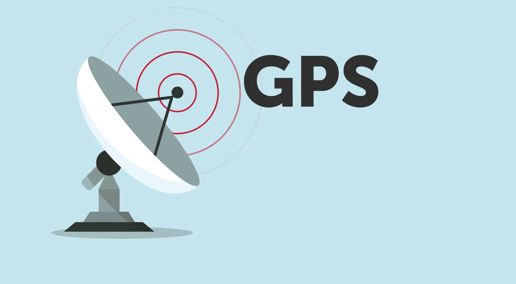
An indepth guide on how does GPS works
Intro
Once upon a time, your ancestors used to look at the night sky to determine their location. Then we used a Thomas Guide, remember those? Today, it only takes one magical technology to get driving directions, send your picnic spot to a lost friend, or track how far you’ve gone during a workout. That technology is called GPS, and you’re about to find out the secret behind it.
Starting
GPS stands for global positioning system and actually was build for military applications.Its first name was navstar and the first satellite for GPS was launched in Feb 22, 1978 and many others were launched suceeding it out of which some failed also.GPS became fully functional in the US by 1995 and the first GPS to used in the car was in 1996.The highest quality signals were used by the military till may 2000 after which it was made available to general public.
Actaully it was designed for use only by the military purposes and not for civialians but an incident on Sept 1, 1983 made the US government to make it available to all countries.What happened was a Korean Airline flight 007 scheduled from New York to Seoul and taking a total of 269 peoples and due to non availability of the GPS it went into the prohibited air space of the Soviet Union and was ultimately shot down by the Soviet Union missiles.All the peoples died and after that the then president of United States gave a statement that it will be soon available to general public.
Working
In any GPS unit there is a GPS reciever embedded which receives the signals sent from the GPS satellites.The satellites orbiting the earth after a definite time interval send signals to the GPS device.In that signal the current position of the satellite and the time of sending is there.
For the exact time measurements there are atomic clocks fitted into the satellites.These clocks are build such that it can show correct time for millions of years without any maintainence.When the signals are received by a GPS device it reads the message and then subtracts the time at which the satellite sends the data and the time the GPS device receives the data.
As a result of this the GPS device conforms it location with respect to that satellite.When a particular GPS device receives the signal from three differnet satellites, it can conform its location on the earth. This process is called as 3D triliteration.
Triliteration
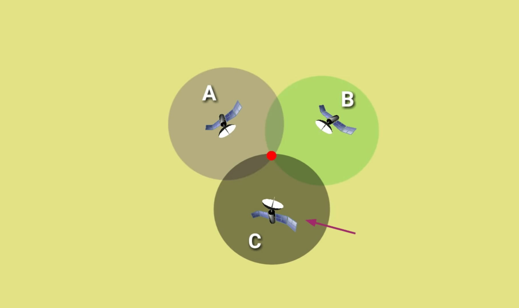
To understand this term consider the above image.Consider you are at the red dot with a GPS device.Now when you switch on your device's GPS service then it gets a signal from satellite A confirming that it is in the range of satellite A but it maybe anywhere in that circle. After that it will get a signal from satellite B and also confirms that it is in range of satellite B also. So the common regions of the A and B are noted as you will be in the common region between the two satellites.After that it collects data from satellite C and when you are in the range of C also they will get your location.You might have known about the errors in the position due to GPS this is due to this phenomenon only.
Complications
- As the GPS uses only 3 satellites for locating so the results produced may not be correct.
To solve this th GPS uses 4 satellites for this and thus the location is far more accurate. - The time move faster in places where there is less gravity.This is in accordance with the Einstien theory of relativity.Due to this the atomic clocks on the satellites are getting 38 microseconds faster than the actual timing on the earth.If nothing done GPS location will be off 6 miles everyday.
This also can be solved by using a fourth satellite.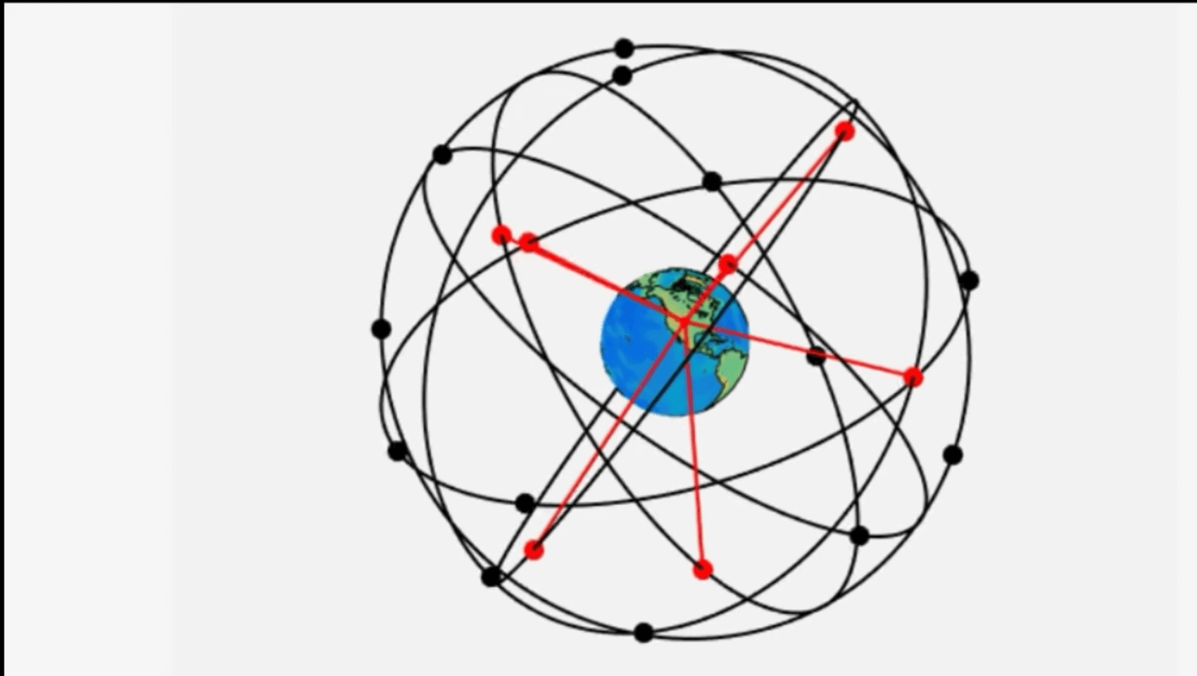
Facts
- The satellites orbiting the earth for GPS are placed such that at all times each device can have access for atleast 4 satellites and its exact locations can be found out.
- The GPS used in our smartphones are of types AGPS which is Assisted Global Positioning System.This uses internet facility and assistant servers which helps in faster location detection. When location services of the device are switched on the system first connects to the assistant GPS servers which have already collected the data of the satellites present in that area.
Thus this helps in faster location detection. 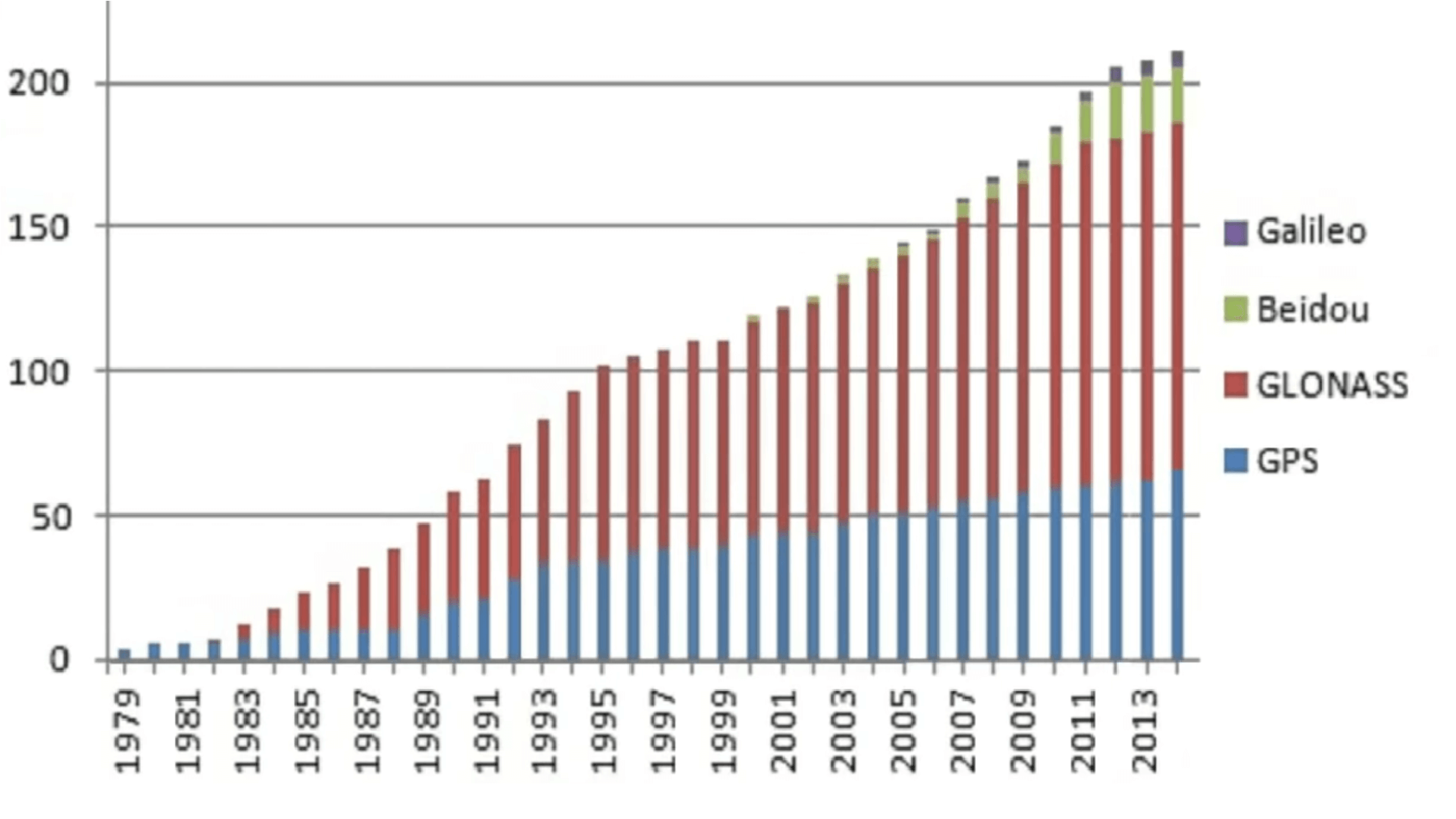
Except for GPS only Glonass is present which gives it service worldwide to everyone.This is operated by the Russia.Also there are other systems like Galileo ehich is operated by European Union and Beidou operated by the Chinese government.But these two are local services that means it does not provide worldwide services.- India also has developed a navigation system called NAVIK which is used by the Indian army in the Indian subcontinent.This developed in response to the US not letting India use the GPS during the Kargil war and thus NAVIK was developed.
To check out the most epic fails of google maps watch the video below
SOURCE VIDEO